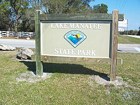
| Lake Manatee State Park | |
|---|---|
 Lake Manatee State Park: Park sign | |
| Location | Manatee County, Florida, USA |
| Nearest city | Bradenton, Florida |
| Coordinates | 27°28′41″N 82°20′10″W / 27.47806°N 82.33611°W |
| Governing body | Florida Department of Environmental Protection |
Lake Manatee State Park (Lake Manatee State Recreation Area) is a 556-acre (2.3 km2) State Park in the U.S. state of Florida, located on the south shore of 2,400-acre (10 km2) Lake Manatee. It is 9 miles (14 km) east of I-75 on State Road 64 in Bradenton. It is made up of pine flatwoods, Sand Pine scrub, marshes, and hardwood forests.
Activities include canoeing and kayaking, camping, boating, picnicking, swimming. Among the wildlife of the park are alligators, turtles, osprey. Amenities include a 60-site campground, boat ramp, dock, and picnic area. The park is open from 8:00 am till sundown year-round.
External links
![]() Media related to Lake Manatee State Park at Wikimedia Commons
Media related to Lake Manatee State Park at Wikimedia Commons
- Lake Manatee State Park at Florida State Parks
- Lake Manatee State Park at StateParks.com
- Lake Manatee State Recreation Area at abfla.com
- Lake Manatee State Recreation Area at Wildernet.com


Hey There!!
Ya know how ya always wonder if those awesome recommendations you see on some websites might be written by the owners?
Well… This is one of those. Let me put your mind at ease and I’ll just come out and say it. Our products our awesome!!!
I hope everyone else feels the same way and posts their comments here 🙂
Enjoy every precious moment
Joe Zia